GeoPro™ Inertial Navigation System (INS)
Customized Geo Data for Every Application.
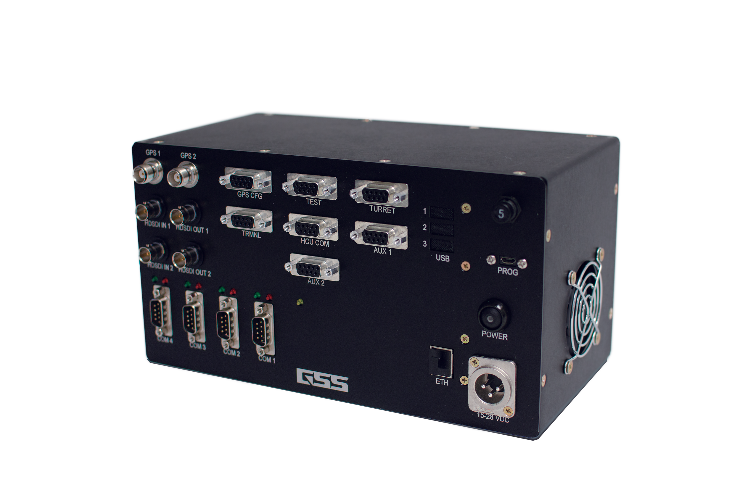
Highly accurate inertial navigation system with internal IMU. The entire software stack, owned by GSS, allows for complete customization of data feed output and external gimbal control.
Our goal with the GeoPro™ is to provide a geo-location system with excellent accuracy and flexibility that can be adapted to a number of applications. Similar to how our gimbal is an open platform stabilization system, the GeoPro™ has built-in flexibility that allows for customization depending on the application for which it will be used.
Learn the features and functions of the GeoPro™ INS in our video library.
Inertial Navigation System (INS)
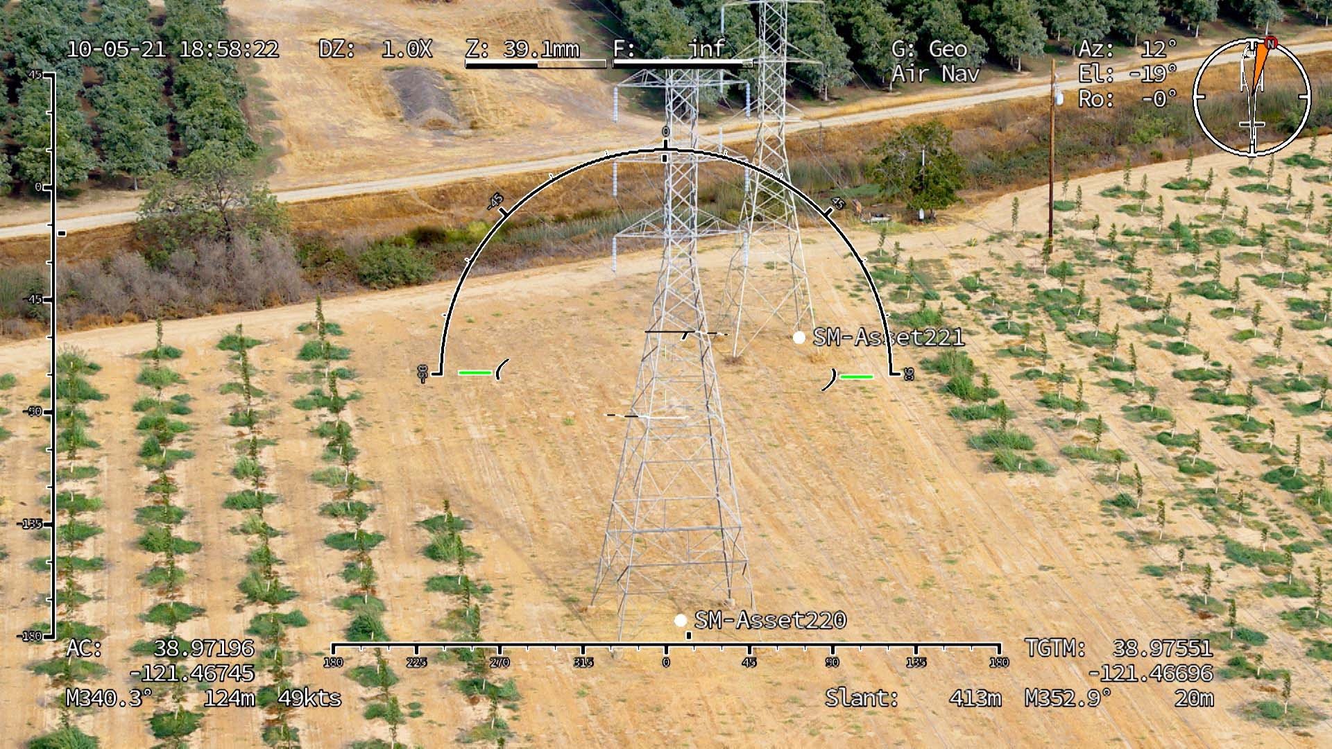
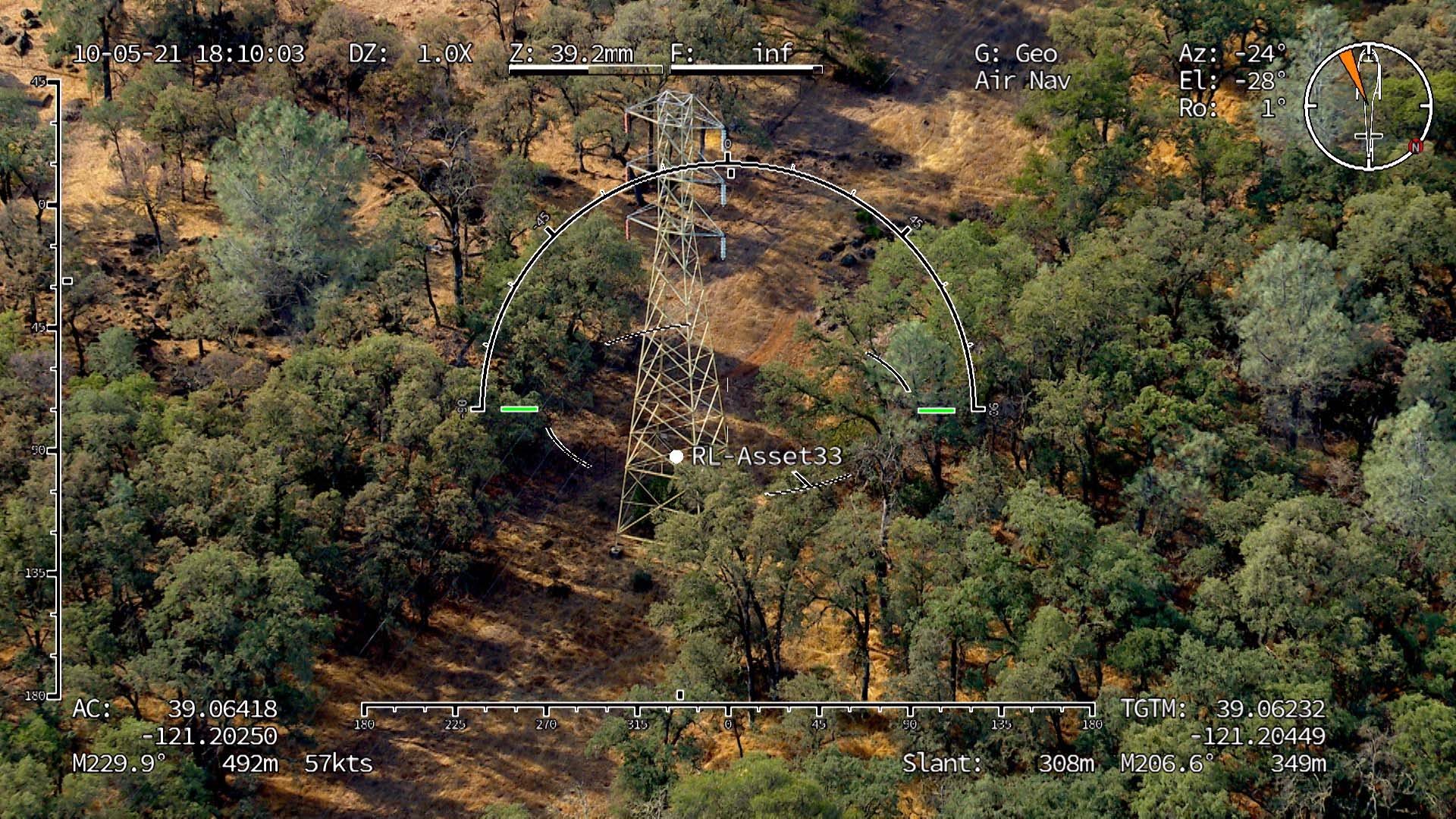
Geo Overlay
Pilot Assistance
Metadata Insertion
Heading Input Correction
Geo-locking
GSS Overlays
Focus
KML Point Display
KML Import
Digital Elevation Model
INS: GSS CTO Steve Rudolph explains how the INS is the “heart” of the GeoPro System.
GEO OVERLAY: Geo Overlays and Geo Steering are integral components to the GeoPro.
GEO LOCK: The geo-lock feature makes the GeoPro™ very simple to use.
GSS OVERLAYS: The overlays offer a creative and flexible way to highlight specific project areas and denote captured targets.
KML POINT DISPLAY: Capture images and organize data with KML points.
KML IMPORT: Drag and drop simplicity or utilize a media thumb drive to import KML points.
METADATA INSERTION: The GeoPro™ is capable of turning metadata into real points on the ground. All you need is the file.
DIGITAL ELEVATION MODEL: Working with digital elevation models to achieve scope.
FOCUS: Various ways to focus the camera with the GeoPro™ technology.
PILOT ASSIST: How the geo overlays assist the pilot with navigation.
HEADING INPUT CORRECTION: Built-in ability to manually adjust heading drift so INS stays on target.
Record or Stream
In addition to overlaying geo-referenced data on the moving video, the GeoPro™ also allows for streaming or recording geo-data. This can take one of two forms: (1) data can be saved in a .csv format to an external drive at a high update rate, or (2) data can be streamed from the GeoPro™ through a custom Ethernet protocol. To make use of the streaming data, third party software connects to the Ethernet protocol and consumes the data.
System Features
Auto Slewing to KML points
• Reduce operator’s workload in the aircraft
• Eliminate operator error
Gimbal Command protocols available for 3rd party gimbal control
Focus using slant range and DTED data
• More accurate auto focus without using a laser range finder (laser range finder also available)
• Control lens characteristics using slant range
KML import for augmented reality
Accurate digital elevation data
Navigation assistance via Geo-Referenced overlay’s
• Real-time location data, often used by pilots to assist
Infrastructure mapping via GSS PinPoint Technology
• KML file creation via previous flight path
• Data correction
• Provide asset mapping as a service
ArcGIS file compatibility – ESRI
• File compatibility with ArcGIS and other major GIS software systems
Advanced Geo-Pointing Capabilities
• Heading Adjustment (GSS Proprietary Solution)
• Geo Hold/Geo Lock/PinPoint (Hold Gimbal to a Geo Point)
• Geo Steer (Steering a point on the ground)