
GeoPro Inertial Navigation System
HIGHLY ACCURATE INERTIAL NAVIGATION SYSTEM WITH INTERNAL IMU. THE ENTIRE SOFTWARE STACK, OWNED BY GSS, ALLOWS FOR COMPLETE CUSTOMIZATION OF DATA FEED OUTPUT AND EXTERNAL GIMBAL CONTROL.

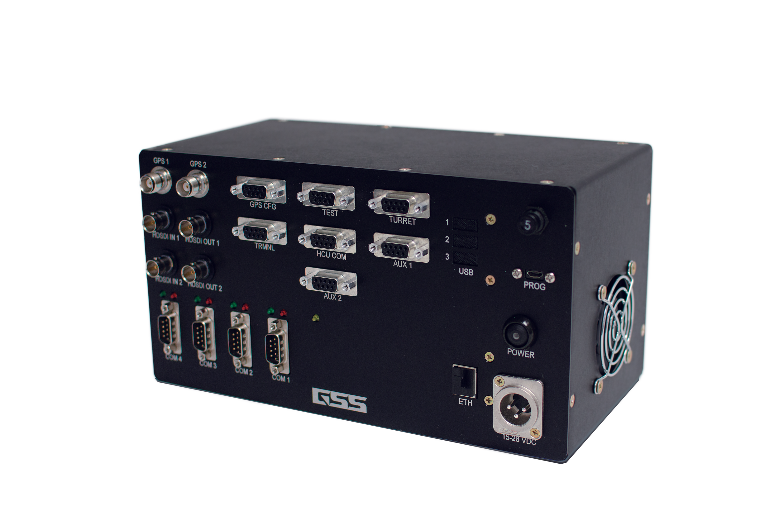

SYSTEM REQUIREMENTS
Auto Slewing to KML points
• Reduce operator’s workload in the aircraft
• Eliminate operator error
Gimbal Command protocols available for 3rd party gimbal control
Focus using slant range and DTED data
• More accurate auto focus without using a laser range finder (laser range finder also available)
• Control lens characteristics using slant range
KML import for augmented reality
Accurate digital elevation data
Navigation assistance via Geo-Referenced overlay’s
• Real-time location data, often used by pilots to assist
Infrastructure mapping via GSS PinPoint Technology
• KML file creation via previous flight path
• Data correction
• Provide asset mapping as a service
ArcGIS file compatibility – ESRI
• File compatibility with ArcGIS and other major GIS software systems
Advanced Geo-Pointing Capabilities
• Heading Adjustment (GSS Proprietary Solution)
• Geo Hold/Geo Lock/PinPoint (Hold Gimbal to a Geo Point)
• Geo Steer (Steering a point on the ground)