
GSS surveillance series
Detect ▸ Recognize ▸ Identify
Lightweight and easy-to-install, GSS Surveillance Turrets give public safety teams the most powerful sensors on the market, enabling data-gathering across visual and infrared bands.
Your mission depends on fast, reliable information gathering. GSS surveillance gimbals allow you to see and identify threats to property and personnel, and to coordinate resources from a position of knowledge.
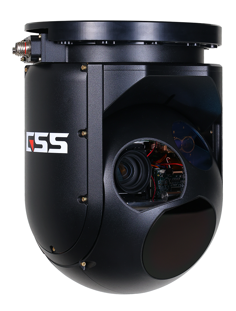
The S410 surveillance gimbal is configured as a single LRU, helping maximize uptime for critical resources.
GSS gimbals set the standard with mission-specific customizations and integration of mapping and geolocation capabilities.
Precision gyro-stabilization for best-in-class results
No ITAR controls on the standard S410 configuration
Best in class customer service
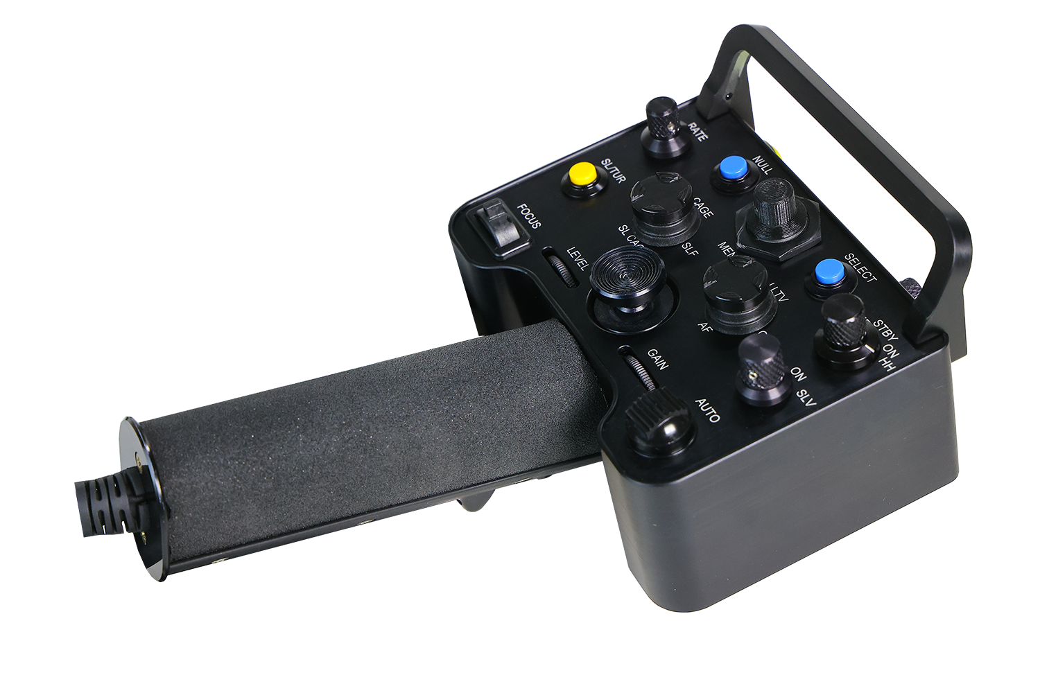
Surveillance Series Hand Controller
Small and intuitive, our hand controller gives you the controls you need, where you need them.


Designed to bring critical situational awareness to high-impact missions, the GSS S410 delivers multi-spectral high-definition imaging for airborne, land and maritime assignments including fire safety, homeland security, search and rescue, ISR and other civilian and military purposes.
Custom payload options include low-light imaging, short-wave infrared (SWIR) thermal imaging, auto-tracker, laser rangefinder, laser illuminator and laser target designator.
Benefits of combined Mid-Wave Infrared (MWIR) and Electro-Optical (EO) Daylight Imaging
Advanced sensors allow operators to see through fog, haze, low light or even total darkness. By integrating MWIR and EO we create a robust and versatile system suitable for a wide range of operational scenarios.
Comprehensive Day/Night Coverage: Get high-resolution color imagery during daylight hours for positive visual identification, and use thermal imaging when subjects are obscured by darkness or haze. Combine the two for round-the clock capabilities.
Enhance Target Identification: EO and MWIR together allow positive target identification even in visibility-challenged environments.
Reduce False Alarms: Enhanced visual information reduces the opportunity for false threat identification.
Improved Situational Awareness: Dual-spectrum observation enhances overall situational awareness to allow better understanding of the environment, enabling faster, more informed decision-making.
Improved Target Tracking: Track heat signatures using MWIR cameras while analyzing detailed visual information via EO to monitor moving targets with improved accuracy and reliability.
Optimized Performance in Challenging Conditions: In fog, smoke, or low light conditions, MWIR bridges an essential gap in image clarity.
Increased Detection Range: MWIR cameras often have longer detection ranges compared to EO cameras, especially in low-light conditions.
Redundancy and Reliability: Combining MWIR and EO cameras provides redundancy, ensuring the overall reliability of the system.
Multi-Sensor Fusion: Image blending from IR and EO cameras allows for multi-sensor fusion, where the strengths of each sensor can be leveraged to provide a more comprehensive and detailed understanding of the surveillance area.
Deterrence and Response: Quickly assess and respond to potential threats.


Optional Sensors include:
Short-Wave Infrared (SWIR): Allows for seeing through haze, fog, and dense smoke delivering clear imaging and visibility.
Spotter Scope: Makes detailed observation of distant objects or targets possible through high magnification optics.
Laser Rangefinder/Laser Pointer: Get instant, accurate distance-to-target measurements with the laser rangefinder and precise targeting with the laser pointer. The combination provides enhanced targeting and improved visibility contributing to better target acquisition.
Laser Illuminator: Provides effective illumination for improved visibility in low-light conditions and over long distances. The narrow beam control minimizes light spill and allows for enhanced night vision, sensor performance and target identification.
fire
safety
law enforcement
military surveillance ISR
Real-Time, Mission Critical Information
Our system offers advanced functionality that integrates seamlessly with information-gathering real-time communication equipment.
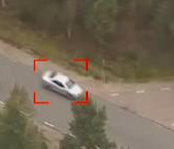
Video Tracker: Robust tracking provides solid designated tracks on moving and non-moving objects in a wide range of applications.
Geo-Pointing: Point to a specific location in seconds. (Latitude/Longitude or Street Address)
Moving Map/Augmented Reality: Follow and mark your path with ease and versatility with system overlays that offer the pilot and tracking team to quickly orient and communicate based on street names and other landmarks.
Geo DVR: Record the entire event for full-motion and geo-spatial awareness and review.
Video & Data Link: Real-time communication with forces on the ground for a successful team mission.
Search Light Slaving: Effortlessly keep subject illuminated in turret line-of-sight for ease of identification, following target and tracking.

Aerial Wildfire Fighting
Combining the capabilities of aerial IR sensors and daylight cameras offers a comprehensive solution for wildfire monitoring, early detection, and management. The integration of these technologies supports more informed decision-making and improves the overall effectiveness of wildfire prevention and response efforts.
Fire Detection
Integrating sensor data with GIS allows for the creation of detailed maps that include thermal and visible information. This integrated approach enhances the effectiveness of wildfire prediction and response.
Fire Mapping
The combined IR and GPS system significantly enhance fire mapping capabilities by providing accurate, real-time data on fire location, intensity, and spread. This information is crucial for effective firefighting and resource management.
Post Event Analysis
Use the collected data as a resource to understand the fire’s behavior, identify areas prone to future incidents and improve predictive analysis.


Law Enforcement
By leveraging multi-spectral imaging in aerial applications, law enforcement can deploy a proactive and sophisticated approach to public safety, staying ahead of criminal activities and safeguarding communities with heightened precision and efficiency. The GSS S410 can penetrate atmospheric obscurants like smoke or fog, providing clear visibility and situational awareness during critical operations.
Suspect Targeting and Identification
MWIR and SWIR enable law enforcement to detect heat signatures and distinguish between objects, aiding in the identification and tracking of individuals.
Enhanced Surveillance Capabilities
The daylight camera provides clear visible imagery during daytime, enhancing overall situational awareness while the IR sensors are particularly useful during nighttime surveillance. They can detect heat sources including individuals, vehicles or other objects emitting infrared radiation.
Search and Rescue (SAR)
Survey vast landscapes and identify potential search areas efficiently. The use of our high-resolution cameras, thermal imaging, and other sensors allows for quick detection of heat signatures, movement, or specific objects on the ground. This technology can aid in spotting missing individuals, especially in challenging environments or low-light conditions.
Ensure Community Safety
Effectively monitor large areas efficiently with the ability to respond promptly to emerging threats.


Military: Intelligence, Surveillance and Reconnaissance (ISR)
Our surveillance turret is designed for accuracy, durability and reliability for even the most complex operations offering situational awareness and supporting critical decision-making. These systems offer flexible mounting options to include land, sea and air.
Aerial Surveillance
Our high-resolution cameras provide real-time aerial surveillance to quickly monitor large areas, track movements, and identify potential threats from an elevated vantage point.
Target Identification
Advanced image recognition and analysis algorithms using machine-learning and Artificial Intelligence (AI) assist in distinguishing between friendly and hostile forces, vehicles, and infrastructure, aiding in target selection.
Reconnaissance Missions
Get detailed surveillance information to assess the situation, identify vulnerabilities, and plan effective strategies.
Border Surveillance
Effectively monitor and secure borders. Detect and track illegal crossings, smuggling activities, and potential security threats along borders.
Multi-spectral Imaging
Low-light and infrared cameras provide visibility in low-light conditions. This is especially crucial for nighttime operations, allowing one to maintain surveillance and respond to threats during darkness.
Strategic Planning
High-resolution imagery and comprehensive surveillance data obtained through the GSS S512 camera system support strategic planning by providing detailed information on terrain, target positions, and critical infrastructure. This aids in formulating effective planning strategies and contingency plans.

“Small and light with world-class sensors, pinpoint accuracy and superior craftsmanship, this system is ready for action.”