

Blog
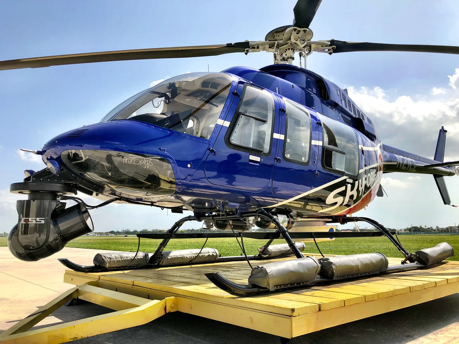
WSVN 7 News Shot On GSS

Want to know what the pros are using? Meet WSVN 7 News, our newest client covering all things Miami. With decades of history of experience under its belt and over 60 hours of newscasts each week, WSVN welcomed summer 2019 with some major upgrades.
Their shiny, new Cineflex Pro now houses an Ikegami HDL-F3000 low-light camera with a Canon 45x9.7 lens. Rigged up to a ship by Helicopter Inc. and paired with the best navigation systems to date, WSVN broadcasting just gained a new edge.
We’ve linked our GSS Inertial Navigation System to Churchill Navigation’s BEAR mapping overlay system. If you saw our blog from last August, you know this is a huge stability improvement. With rock-solid Churchill Maps integration, Geo Lock, Geo Point, and Adjustable Heading, the stability is now unparalleled.
Even in long-term hover, this system’s stability won’t disappoint. No more bumpy footage or shaking maps. When WSVN cruises over Miami for breaking news, their system glides along with them.
Learn more about the GSS Cineflex Pro capabilities here.

From Old to New: A Look at Stabilized Improvements with Churchill Navigation
At GSS, we always look to evolve and improve. At our core, we are engineers that love to create, test and improve our gimbals and technologies to provide the highest quality and latest advancements that integrate with our gimbals. As we analyze old footage, we are proud to see how far our stabilized gimbals have come and are able to offer the best solution for IMU integration.
In this clip, we compared the original solution, External Novatel IMU, to the new, GSS Internal IMU. Both flights featured identical paths over Philadelphia and used Churchill Navigation’s BEAR mapping system with a GSS Cineflex series broadcast gimbal. Notice the incredible stabilization improvements; the street names no longer shake or bounce, and instead, glide smoothly.
What is IMU?
An IMU, Inertial Measurement Unit, detects linear acceleration using an accelerometer and rotational rate using gyroscopes. It reports pitch, roll and yaw status on a continual basis.
We use IMU data as part of an Inertial Navigation Systems (INS). The GSS INS uses the IMU measurements to calculate attitude, angular rates, linear velocity and position relative to a global reference frame. GSS IMU/INS reports the video’s location to Churchill for a live mapping overlay. An accurate IMU data feed results in a stable mapping overlay, as you see in this video.
Learn more about our development of our in-house INS here.
For more information on integrating GSS’s IMU with your system, contact us here.
For more information about our Cineflex Broadcast Series, click here.

GSS Develops and Releases Inertial Navigation System
When you are trying to get stable footage of a car chase or broadcast the 5 o’clock traffic on the news, and your overlay mapping is shaking and bouncing. That’s the worst. We get it.
We’re excited to share that we have developed a new Inertial Navigation System software that solves this big math problem, without an external IMU or trying to jam a 3rd party INS inside our gimbals.
You now have access to rock-solid moving maps with the new GSS INS, straight from the factory.
Take a first-hand look for yourself below.
For the tech-savvy, here’s how it’s accomplished…
GSS has created an Inertial Measurement Unit (IMU) using the existing high-end sensors (gyros and accelerometer) already in the gimbal. Why buy another set? A processor board inside the Gimbal combines IMU and GPS data and hands off the data stream to the moving map interface.
Now GSS owns the entire INS software stack resulting in better stabilization performance than ever before. GSS has more control over the technology and the ability to innovate in a space where others cannot. This means, when the market needs change, we can change the software with it to continually ensure you have the upgraded tools you need.
GSS systems now come geospatially aware straight from the factory with the most stable moving map interface in the ENG/Broadcast market.
Contact us here to learn more or purchase your own!